The Complete Guide to Real Estate Drone Photography in Oregon & Washington
If you're a real estate agent in the Pacific Northwest, you already know that listings with drone photography sell faster and for more money. Aerial shots capture what ground-level photos simply can't — sprawling lots, neighborhood context, proximity to parks and schools, and that stunning mountain backdrop buyers are searching for.
But drone photography for real estate isn't as simple as flying a camera into the sky. Between FAA regulations, state-specific laws in Oregon and Washington, and the technical skill required to get magazine-quality results, there's a lot to know before you invest.
This guide covers everything: what drone photography actually includes, why it matters for your listings, the legal requirements in both states, and how to make sure the aerial media you're getting is worth every dollar.
What Is Real Estate Drone Photography?
Real estate drone photography uses unmanned aerial vehicles (UAVs) equipped with high-resolution cameras to capture aerial images and video of properties. For listings in Oregon and Washington, this typically includes:
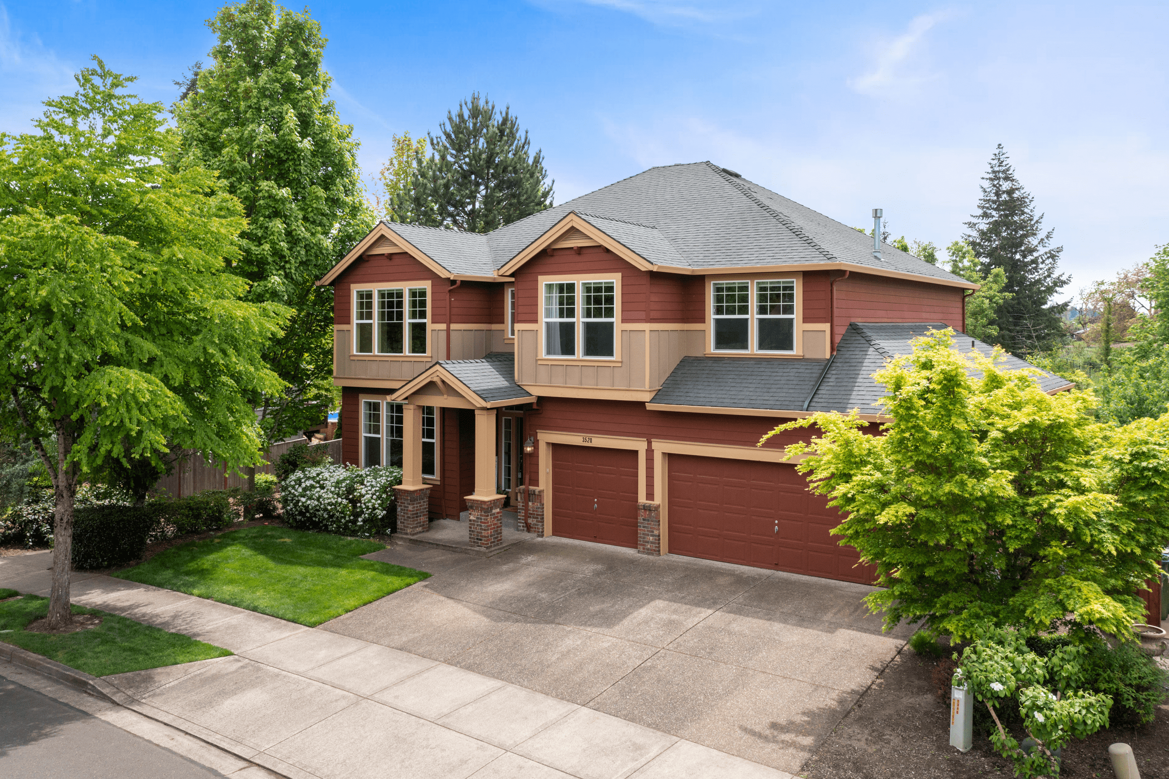
Aerial still photography — high-resolution overhead and angled shots that show the full property, lot boundaries, landscaping, and surrounding area. These are the images that stop buyers mid-scroll on Zillow or Redfin.
Drone video — smooth, cinematic flyovers that give buyers a true sense of the property's scale, layout, and setting. These are especially valuable for acreage, waterfront properties, and homes with views.
Land and lot documentation — for vacant land, new construction, or rural properties, drone photography is often the only way to give buyers a meaningful sense of what they're looking at.
The goal is always the same: show buyers something they can't see from the curb.
Why Drone Photography Matters for Pacific Northwest Listings
The Portland and Vancouver metro areas have a unique combination of features that make aerial photography especially valuable.
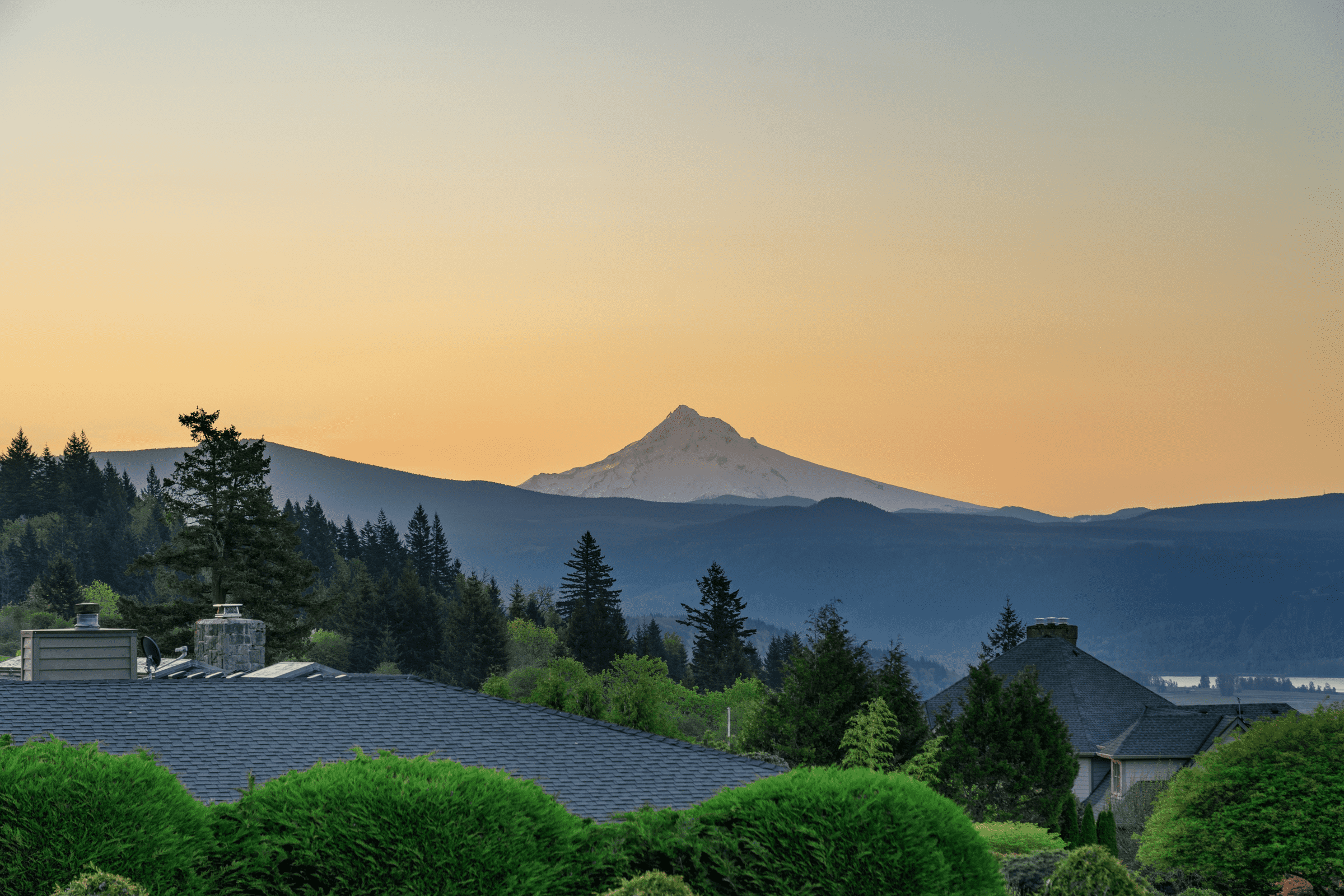
Terrain tells a story. The Pacific Northwest is defined by its geography — river views, mountain backdrops, forested lots, and rolling terrain. A ground-level photo of a home in Camas or Lake Oswego can't capture the fact that it sits on a hillside overlooking the Columbia River. A drone shot can.
Lot size matters here. Properties in Battle Ground, Ridgefield, and rural Clark County often sit on multiple acres. Buyers want to see the full picture — where the property lines fall, what the outbuildings look like from above, and how the land is laid out. Drone photography makes that possible in a way that MLS descriptions never will.
Neighborhood context sells. A home in Beaverton that's a five-minute walk from a light rail station? A listing in the Pearl District with a rooftop view of the Willamette? Drone footage puts those selling points front and center.
It's becoming the expectation. Buyers in the Portland-Vancouver market are savvy. They're comparing your listing against dozens of others online, and listings with aerial photography consistently outperform those without. According to MLS statistics, listings with drone photography receive up to 68% more views and sell up to 32% faster than those with ground-level photos alone.
FAA Regulations: The Federal Baseline
Every commercial drone operation in the United States — including real estate photography — falls under the FAA's Part 107 Small UAS Rule. This applies equally whether you're shooting a $200,000 condo in Gresham or a $2 million estate in Lake Oswego.
Here's what Part 107 requires:
Remote Pilot Certificate. The drone operator must pass the FAA's Aeronautical Knowledge Test and hold a current Remote Pilot Certificate. This isn't optional — it's federal law. Any photographer flying a drone for your listing without this certification is operating illegally, and you could face fines as well.
Remote ID compliance. As of 2024, all drones operated under Part 107 must broadcast Remote ID, which allows the FAA and law enforcement to identify drones in flight. This is the "digital license plate" for drones.
Altitude limit of 400 feet. Drones must stay below 400 feet above ground level unless flying within 400 feet of a structure.
Visual line of sight. The pilot must be able to see the drone at all times during flight — no flying around corners or behind buildings.
Daylight operations. Flights must occur during civil twilight or later, with anti-collision lighting if operating during twilight hours.
No flights over people or moving vehicles without specific waivers or compliance with updated subcategories based on drone weight and risk.
The penalty for non-compliance is significant. Fines can reach up to $32,666 per occurrence for the drone pilot, and approximately $11,000 per occurrence for the real estate agent or brokerage that hired them. This is why working with a certified, insured professional isn't just a quality decision — it's a liability decision.
Oregon Drone Laws for Real Estate Photography
Oregon adds its own layer of regulations on top of the federal rules. If you're listing properties anywhere in the Portland metro, the Willamette Valley, or along the Oregon Coast, here's what applies:
Private property protections. Under ORS 837.370, it's illegal to operate a drone over private property in a way that intentionally, knowingly, or recklessly harasses or annoys the property owner or occupant. For real estate photographers, this means being mindful of neighboring properties during shoots.
State park and public land restrictions. Flying drones in Oregon State Parks requires a permit from the Oregon Parks and Recreation Department. If a property borders parkland or you want to capture surrounding public land in your aerial footage, the photographer needs to have permits in place.
Oregon Department of Aviation coordination. Commercial drone operations that involve filming on or launching from protected lands often require coordination with the Oregon Department of Aviation, including proof of insurance and a safety plan.
Local jurisdiction rules. Cities like Portland, Bend, and Eugene may have additional municipal restrictions, particularly near public buildings, in busy urban areas, or in designated no-fly zones near airports.
Washington State Drone Laws for Real Estate Photography
Washington has some of the more specific state-level drone regulations in the country. If you're listing in Vancouver, Camas, Ridgefield, Battle Ground, or anywhere in Clark County, these rules apply:
State registration required. Commercial drones operating in Washington must be registered with the WSDOT Aviation Division. The fee is $15 per year per aircraft. This is separate from FAA registration.
Physical labeling. Every drone operated in Washington must display the operator's name and telephone number as a physical label on the aircraft.
Liability insurance mandate. Washington requires a minimum of $100,000 in liability insurance for commercial drone operations. Your drone photographer should carry this — and you should ask for proof.
Privacy protections. Washington law explicitly prohibits recording or capturing images of private areas — home interiors visible through windows, backyards, patios, pool areas — without the property owner's consent.
Critical infrastructure restrictions. Flying over critical infrastructure (power plants, water treatment facilities, etc.) is prohibited.
What to Look for When Hiring a Drone Photographer
Not all drone photography is created equal. Here's what separates professional-grade aerial media from the amateur footage that hurts more than it helps:
FAA Part 107 certification. This is non-negotiable. Ask to see their Remote Pilot Certificate. If they hesitate, walk away.
Insurance. Your photographer should carry liability insurance that meets or exceeds Washington's $100,000 minimum — ideally more. This protects you, your client, and their property.
Professional-grade equipment. Consumer drones produce consumer-quality results. Look for photographers using commercial platforms with large sensors, RAW image capability, and cinematic video features.
Post-production expertise. The raw footage off a drone is just the starting point. Professional color grading, exposure correction, and editing are what turn aerial images into listing assets that actually sell homes.
Turnaround time. In a fast-moving market, waiting a week for drone photos means missed buyer interest. Look for providers who can deliver within 24–48 hours.
Local knowledge. A drone photographer who knows the Portland-Vancouver area understands the airspace restrictions, the best angles for mountain views, the golden hour timing across seasons, and which properties benefit most from aerial coverage.
When Is Drone Photography Worth the Investment?
Drone photography adds value to almost any listing, but it's especially impactful for:
Properties on large lots — anything over a quarter acre benefits dramatically from aerial context. Acreage properties in Ridgefield, Battle Ground, or rural Clark County practically require it.
Homes with views — if the property has mountain, river, valley, or city views, drone photography is the only way to convey that to online buyers.
Waterfront properties — whether it's the Columbia River, the Willamette, or a lakefront lot, aerial footage captures the relationship between the home and the water in a way ground photos can't.
New construction and land — for lots, new builds, and development projects, drone photography shows progress, context, and potential.
Luxury listings — high-end buyers expect premium marketing materials. Aerial photography signals that the listing (and the agent) are operating at that level.
Properties near desirable amenities — parks, trails, schools, shopping districts, and transit — drone footage can showcase proximity in a single frame.
How Sage Aesthetic Handles Drone Photography
At Sage Aesthetic, drone photography and videography have been part of our core real estate media services since the beginning. With over 2,000 properties photographed across the Vancouver, WA and Portland, OR metro areas, we've built our aerial workflow around three things that matter most to agents:
Compliance is handled. Our pilots are FAA Part 107 certified, carry full liability insurance exceeding state minimums, and maintain current Washington WSDOT registration. We handle the regulatory side so you don't have to think about it.
Quality is consistent. We shoot with professional-grade equipment and apply the same color grading and post-production standards to aerial media that we do to our interior and exterior photography. Every image is delivered ready to use — no additional editing needed on your end.
Turnaround is fast. We deliver drone photography and video within our standard 24-hour turnaround window, because we know that in this market, speed matters as much as quality.
Whether you need aerial stills for an MLS listing, cinematic drone video for a luxury property, or land documentation for a development site, we've got you covered across Vancouver, Camas, Ridgefield, Battle Ground, Portland, Beaverton, Lake Oswego, and everywhere in between.
Ready to Elevate Your Listings?
If you're listing properties in Oregon or Washington and you're not using professional drone photography, you're leaving money on the table — both for your clients and for your business.
Book your next shoot at properties.sageaesthetic.com or reach out to our team at team@sageaesthetic.com or (360) 977-2049. We'd love to show you what your listings look like from above.
Sage Aesthetic is a professional real estate photography, videography, and drone media company serving Vancouver, WA, Portland, OR, and the surrounding Pacific Northwest metro areas. With 7+ years of experience and 2,000+ properties photographed, we specialize in fast-turnaround, magazine-quality visual media that helps agents win listings and close deals.